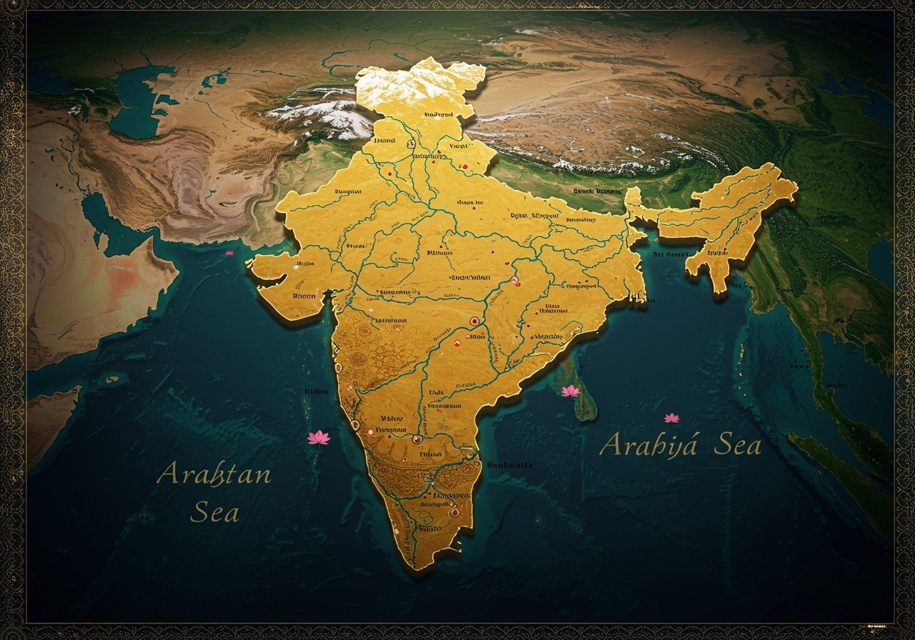
The Indian subcontinent, a region of geographical and cultural richness, encompasses a vast and diverse landscape. Understanding its physical and political geography is key to appreciating its complexity and significance. This article delves into the multifaceted aspects of the Indian subcontinent, exploring both its natural and man-made divisions.
Defining the Indian Subcontinent
The Indian subcontinent, situated in Southern Asia, stands as a distinct entity due to its unique geological and cultural characteristics. It is geographically defined by:
- The Himalayas: This towering mountain range forms a natural northern barrier, home to some of the world’s highest peaks, influencing weather patterns and creating unique ecosystems.
- The Indian Ocean: To the south, the vast Indian Ocean plays a significant role in the region’s climate, trade routes, and cultural interactions throughout history.
- The Arabian Sea: The western boundary, the Arabian Sea, has been a vital maritime route, connecting the subcontinent to the Middle East, Africa, and Europe.
- The Bay of Bengal: The Bay of Bengal, forming the eastern edge, influences the monsoon patterns, crucial for agriculture and shaping the coastal regions’ ecosystems.
The subcontinent includes the countries of India, Pakistan, Bangladesh, Nepal, Bhutan, Sri Lanka, and the Maldives, each contributing to the region’s rich tapestry of cultures and traditions.
Physical Geography of the Indian Subcontinent
The Indian subcontinent showcases a remarkable variety of physical landscapes:
- Himalayan Mountain Range: More than just a northern border, the Himalayas are a complex system of ranges, valleys, and glaciers, influencing the climate and biodiversity of the entire subcontinent.
- Indo-Gangetic Plain: This incredibly fertile plain, formed by the Indus and Ganges rivers, supports a dense population and extensive agriculture, crucial for the region’s food security.
- Deccan Plateau: A large plateau in central India, the Deccan Plateau, is known for its unique geological formations, rich mineral resources, and distinct flora and fauna.
- Thar Desert: Spanning parts of India and Pakistan, the Thar Desert presents a challenging yet fascinating ecosystem, with unique adaptations of plants and animals to arid conditions.
- Western and Eastern Ghats: These mountain ranges along the western and eastern coasts of India play a vital role in influencing rainfall patterns, creating diverse microclimates, and supporting rich biodiversity.
Climatic Zones and Natural Resources
The Indian subcontinent experiences a range of climatic conditions and possesses abundant natural resources:
- Climatic Zones: From tropical monsoons to arid deserts and temperate highlands, the diverse climates support a wide range of ecosystems and agricultural practices.
- Monsoon System: The annual monsoon rains are essential for agriculture, replenishing water resources, and shaping the lives and livelihoods of millions across the subcontinent.
- Natural Resources: The subcontinent is rich in minerals, forests, and waterways, providing resources for various industries and contributing significantly to the region’s economy.
Political Geography of the Indian Subcontinent
The political map of the Indian subcontinent is a complex tapestry woven with history, culture, and political dynamics:
- Countries: The subcontinent comprises India, Pakistan, Bangladesh, Nepal, Bhutan, Sri Lanka, and the Maldives, each with its own distinct political system and governance structure.
- Capitals and Major Cities: Each country within the subcontinent has its own capital and major cities, each serving as centers of administration, commerce, and cultural expression.
- Political Systems: The political systems of these countries vary, ranging from parliamentary democracies to constitutional monarchies and republics, reflecting the diversity of governance in the region.
- Historical Context: The political landscape has been shaped by historical events such as the partition of India, the creation of Bangladesh, and ongoing territorial disputes, adding layers of complexity to the regional dynamics.
India’s States and Union Territories
Within India, the administrative structure is further divided into states and union territories:
- Current Administrative Divisions: India is comprised of 28 states and 8 union territories, each with its own administrative structure and degree of autonomy.
- Governance: This division facilitates regional governance, addressing the diverse needs and priorities of different parts of the country while maintaining national unity.
- Key States: Each state has its own capital and distinctive cultural and economic characteristics, contributing to the overall diversity and dynamism of India.
Geopolitical Significance of the Indian Subcontinent
The Indian subcontinent holds significant geopolitical importance on the world stage:
- Strategic Location: Situated at the crossroads of major trade routes, the subcontinent plays a crucial role in global commerce and maritime activity.
- Regional Security: The political stability and security of the subcontinent are vital for maintaining peace and balance in the broader region, impacting global geopolitics.
FAQs About Mapping the Indian Subcontinent
What defines the Indian subcontinent geographically? The Indian subcontinent is geographically defined by the Himalayas to the north, the Indian Ocean to the south, the Arabian Sea to the west, and the Bay of Bengal to the east.
What does a physical map of the subcontinent show? A physical map illustrates the natural features such as mountains (Himalayas, Western and Eastern Ghats), rivers (Indus, Ganges, Brahmaputra), plains (Indo-Gangetic Plain), deserts (Thar Desert), and plateaus (Deccan Plateau).
What information does a political map provide? A political map displays the boundaries of countries (India, Pakistan, Bangladesh, etc.), states within India, and the location of major cities, providing insights into the political divisions and administrative structure.
How can I access maps of the Indian subcontinent? You can find maps of the Indian subcontinent in various resources such as atlases, online map services (e.g., Google Maps, MapsofIndia.com), and educational websites. The Survey of India offers free downloads of various types of maps in multiple languages.
Poojn.in: Connecting with India’s Sacred Geography
As you explore the diverse geography of the Indian subcontinent, connect with its rich cultural heritage through Poojn.in, India’s leading online store for puja samagri and cultural goods. We offer a wide selection of authentic products, including alta, diyas, incense, and more, sourced from across India, helping you engage with the traditions of different regions.
Explore our collection:
- Sindoor (Vermilion): Discover various types of sindoor used in different regions, connecting you to the diverse marital customs across the subcontinent.
- Camphor: Experience the aromatic camphor used in rituals across India, representing purity and connecting you to the spiritual practices of the region.
- Candles and Diyas: Light up your puja space with traditional diyas and candles, symbolizing light and knowledge, and connecting you to the spiritual heart of India.
Visit Poojn.in today and discover the rich cultural heritage of the Indian subcontinent.
Conclusion
Exploring the Indian subcontinent’s diverse physical and political geography reveals a region of immense beauty, complexity, and global significance. By understanding its landscapes, climates, and political divisions, we gain a deeper appreciation for the rich cultural tapestry and the dynamic forces that shape this vibrant part of the world.


