The Deccan Plateau stands as one of India’s most prominent geographical features, renowned for its distinctive terrain, abundant cultural heritage, and historical significance. Spanning a vast area across southern and central India, this plateau is recognized for its diverse ecosystems, ancient geological formations, and vital role in the country’s history. This article delves into the geography of the Deccan Plateau, encompassing its location, area, shape, and other key aspects to provide a comprehensive understanding of this remarkable region.
Deccan Plateau Location
The Deccan Plateau is strategically located in the southern part of the Indian subcontinent, bordered by the Western Ghats to the west and the Eastern Ghats to the east. This expansive plateau stretches across eight Indian states, including Telangana, Maharashtra, Andhra Pradesh, Karnataka, Kerala, and Tamil Nadu. It rises from the coastal plains of the Arabian Sea in the west to the Bay of Bengal in the east.
The geological significance of this location influences the region’s climate and biodiversity. Historically, the plateau’s position has been crucial as a crossroads for ancient trade routes and cultural exchanges.
Deccan Plateau Area
Covering approximately 422,000 square kilometers (163,000 square miles), the Deccan Plateau is one of the world’s largest plateaus, forming a significant portion of peninsular India and contributing to a substantial part of the country’s landmass. The plateau encompasses diverse regions, each with distinct geographical features:
- Malwa Plateau: This region is known for its fertile land and historical significance. It played an important role in ancient Indian history, hosting several kingdoms and empires.
- Chota Nagpur Plateau: Rich in mineral resources, this plateau is an important industrial area. It’s also known for its unique tribal cultures and traditions.
- Karnataka Plateau: Situated in southwest India, this plateau is known for its coffee plantations, diverse wildlife, and scenic landscapes. It’s a major contributor to India’s coffee production.
The plateau’s diverse topography includes hills, valleys, and river basins that influence agriculture and settlement patterns. Key rivers originating from the plateau, such as Godavari, Krishna, and Kaveri, play a vital role in the region’s agrarian economy.
Deccan Plateau Shape
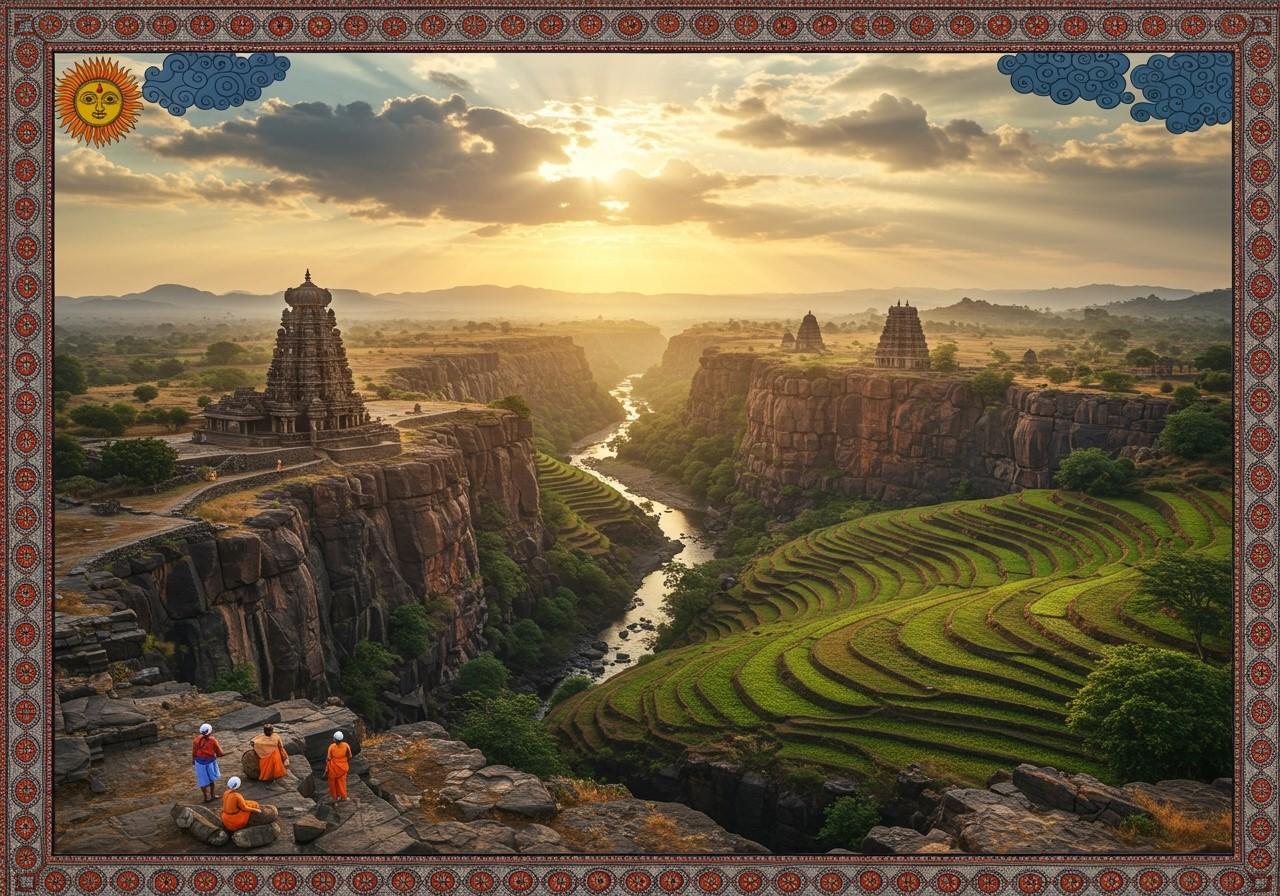
The Deccan Plateau is roughly triangular, tapering towards the south, with its base formed by the Satpura Range in the north. The plateau’s elevation ranges from approximately 600 meters (2,000 feet) on average, varying across different regions.
Its geological formation dates back to the Precambrian era, with volcanic origins contributing to the fertile black soil known as ‘Regur’ soil. The plateau’s shape influences climate patterns, with the Western Ghats acting as a barrier to monsoon winds, creating distinct wet and dry seasons.
Deccan Plateau Map
A detailed map of the Deccan Plateau reveals its vast expanse and distinctive physical features. It stretches from the Satpura and Vindhya Ranges in the north to the northern fringes of Tamil Nadu in the south, bordered by the Western and Eastern Ghats. The plateau spans over eight Indian states, including Telangana, Maharashtra, Andhra Pradesh, Karnataka, Kerala, and Tamil Nadu.
The map highlights geographical landmarks like the Nilgiri Hills, known for their lush landscapes and tea plantations. The Western and Eastern Ghats form natural boundaries, while major rivers like the Godavari, Krishna, and Kaveri originate from the plateau and flow towards the Bay of Bengal.
Understanding the geography of the Deccan Plateau through a map helps in appreciating its diverse ecosystems, including forested regions rich in flora and fauna. Wildlife sanctuaries such as Nagarhole National Park and Bandipur National Park offer a glimpse into India’s biodiversity.
The map also shows how the plateau’s geography has influenced human settlement and urbanization. Major cities like Bangalore, Hyderabad, and Pune are situated on or near the Deccan Plateau, becoming important cultural and economic hubs.
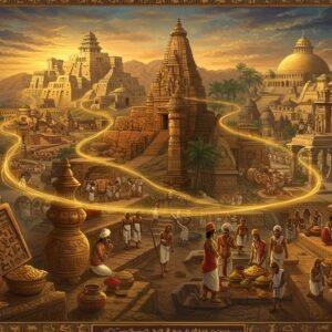
Historical and cultural landmarks dot the plateau, reflecting its rich heritage. The ancient cave complexes of Ellora and Ajanta, famous for their intricate carvings, stand as testaments to its historical significance. Temples, forts, and other architectural marvels tell stories of the region’s glorious past.
How Poojn.in Supports Your Spiritual Needs Across the Deccan Plateau
Poojn.in caters to devotees across the Deccan Plateau with authentic puja items and religious supplies. Our extensive delivery network covers major cities and towns throughout the plateau, including Hyderabad, Bangalore, Pune, and Nagpur. We offer region-specific items aligned with local customs and traditions.
For temples and sacred sites, we provide essential puja samagri:
- Pure copper and brass items: Ideal for traditional temple rituals, ensuring authenticity and sanctity. Discover our collection of copper and brass puja items.
- Traditional cotton wicks: Crafted for temple lamps, promoting a serene and spiritual atmosphere. Learn more about the significance of aarti.
- Pure ghee for sacred offerings: Sourced responsibly to maintain purity and sanctity in rituals. Understand the importance of pure ingredients in puja rituals.
Our online platform and mobile app provide convenient access to these items across the Deccan region. We adhere to strict quality standards, ensuring all ritual items meet traditional requirements. Visit www.poojn.in or download our mobile app to explore our complete range.
Conclusion
Exploring the Deccan Plateau through its map reveals a region of immense geographical significance and cultural richness. This vast plateau, bounded by the Western and Eastern Ghats, encompasses diverse ecosystems, important rivers, and verdant landscapes. The Deccan Plateau is not merely a geographical wonder but also a cultural and historical treasure, with major cities like Bangalore, Hyderabad, and Pune thriving as cultural and economic hubs.
The ancient caves of Ellora and Ajanta, along with numerous temples and forts, narrate stories of a rich heritage. Understanding the geography of the Deccan Plateau fosters a deeper appreciation of its natural beauty and historical importance. The region connects India’s past with its present, offering wonder and knowledge to all who explore it.
Deccan Plateau Geography: FAQs
Where is the Deccan Plateau located? The Deccan Plateau is situated in southern India, occupying a significant portion of the Indian peninsula.
What is the area of the Deccan Plateau? The Deccan Plateau covers an area of approximately 422,000 square kilometers (163,000 square miles).
What shape is the Deccan Plateau? The Deccan Plateau is roughly triangular, bordered by mountain ranges on three sides.
Can I find a map of the Deccan Plateau? Yes, numerous maps of India clearly depict the Deccan Plateau, highlighting its location and surrounding geographical features.
What are the key features of the Deccan Plateau’s geography? The Deccan Plateau is characterized by its flat-topped hills, fertile valleys, and rich volcanic soil.
Which mountain ranges border the Deccan Plateau? The plateau is bordered by the Western Ghats to the west, the Eastern Ghats to the east, and the Satpura and Vindhya Ranges to the north.
What is the climate like on the Deccan Plateau? The Deccan Plateau experiences a semi-arid to tropical climate, with hot summers, mild winters, and seasonal monsoons.
Why is the Deccan Plateau important? The Deccan Plateau holds significance due to its rich natural resources, fertile lands suitable for agriculture, and historical relevance in Indian civilization.